DETAILS
TITLE – Town Hall, Oxford
SERVICE – 2D Measured Building Survey
METHOD – 3D Laser Scan, GPS, UAV Drone
SPECIFICATION – Level 2 – Standard Detailing, PAS-128
DELIVERABLES – 2D Floor Plans, Roof Plan, Elevations
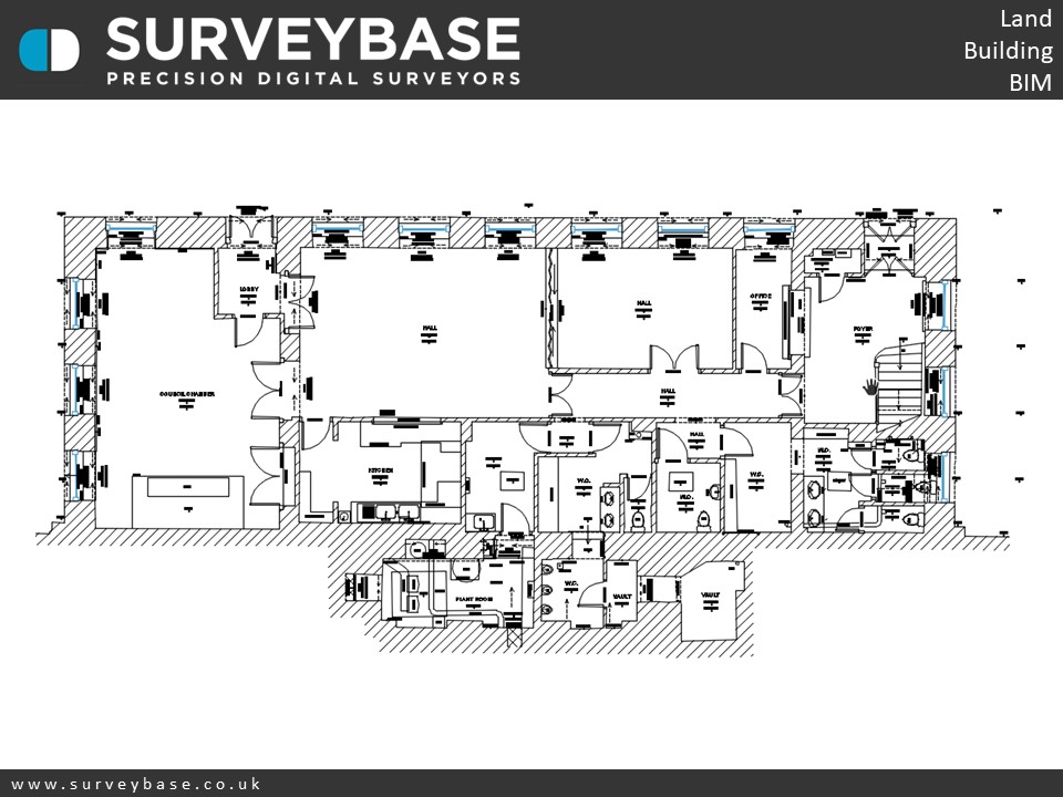
Ground Floor Plan
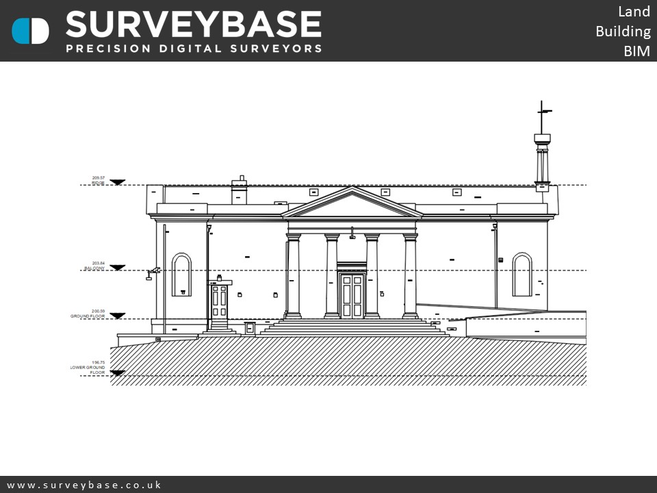
Front Elevation
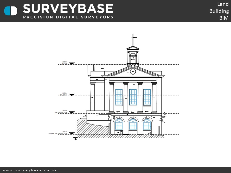
Side Elevation
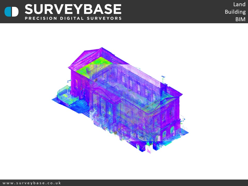
Pointcloud 1
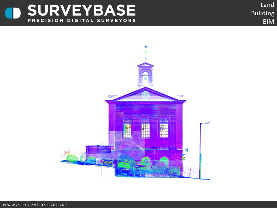
Pointcloud 2
SUMMARY
The digital Measured Building & Drone Survey of Town Hall, Oxford.
The Grade II listed municipal Town Hall was built in 1842 in Palladian Style designed by George Stanley Rupton and was the seat of local Government up until 1974.
The interior of building was severely damaged in a fire in 1950 though the shell survived. The building is now a venue for the surrounding community providing wedding receptions, meetings, conferences, exhibitions and fitness classes.
The survey was undertaken with a Faro X330 Laser Scanner, GPS and UAV Drone. The output included precision 2D AutoCAD Floor Plans, Elevations and Roof Plan.
If you would like to find out more about our Topographical, Measured Building, or Scan To 3D Revit survey services please visit the Surveybase website or call your local office; Bristol 01225 314370, Reading 0118 2072508 or London 02039 066892 .
To obtain a quotation please email your brief to quote@surveybase.co.uk or use our online quotation portal; Fast Quote.
Surveybase Limited are a precision digital surveying practice working on residential and commercial developments across the South of The U.K.