DETAILS
TITLE – Manor House, Oxford
SERVICE – Topographical & Measured Building Survey
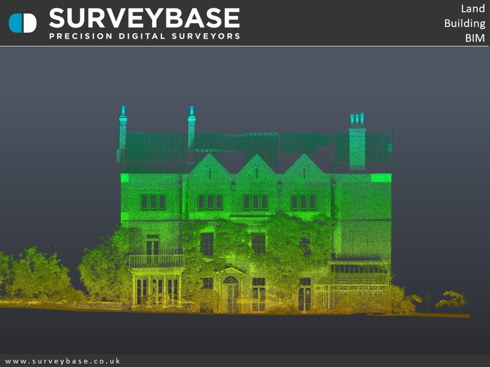
METHOD –3D Laser Scan, Total Station, UAV Drone, GPS
SPECIFICATION – Level Of Detail – L3 Heritage Standard
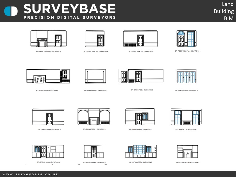
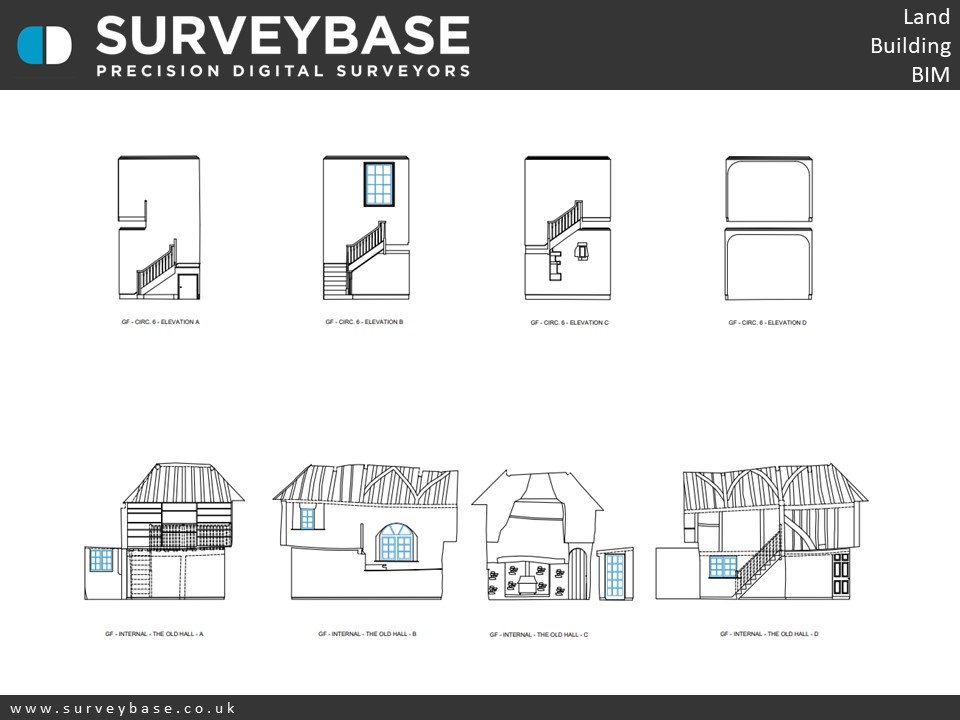
DELIVERABLES – 2D DWG L3 Heritage Standard Site Plan, Floor Plans, Elevations, Sections, Roof Plan, Internal Elevations
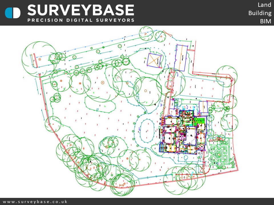
TOPO
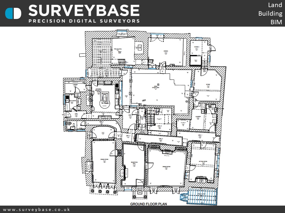
Ground Floor Plan
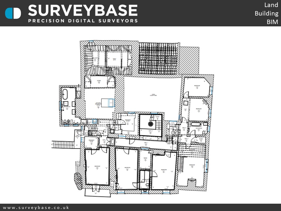
1ST FLOOR PLAN

2ND FLOOR PLAN

roof plan
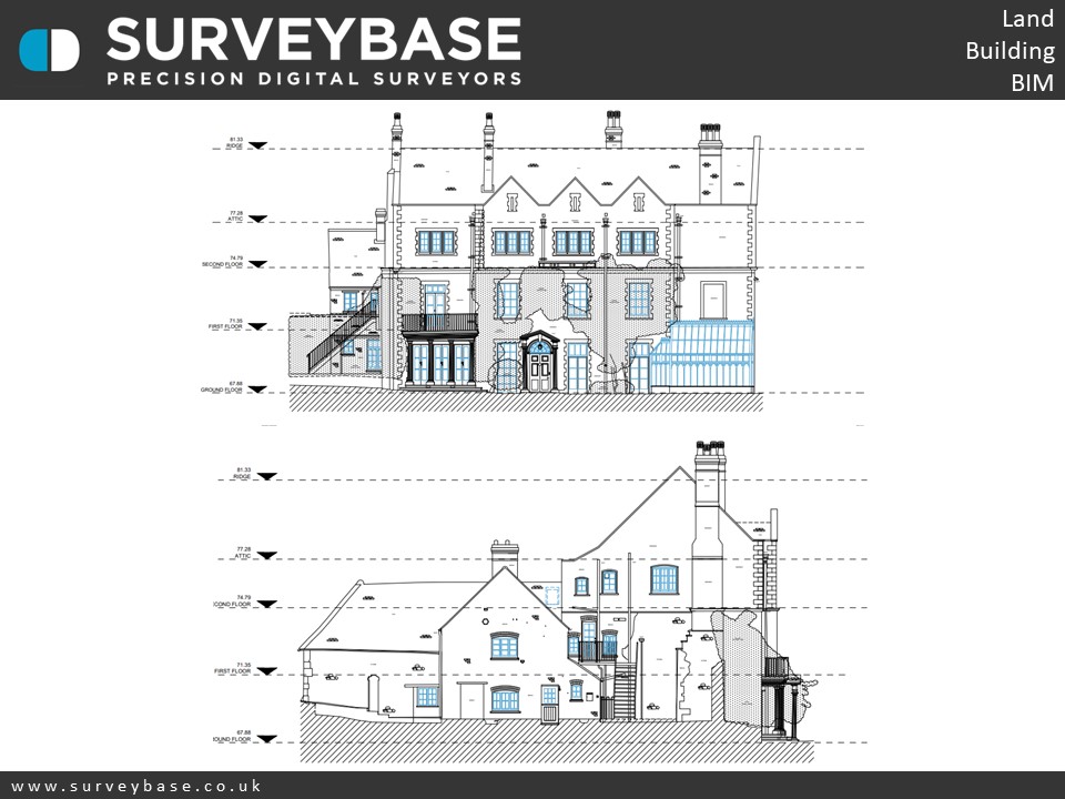
elevations
SUMMARY
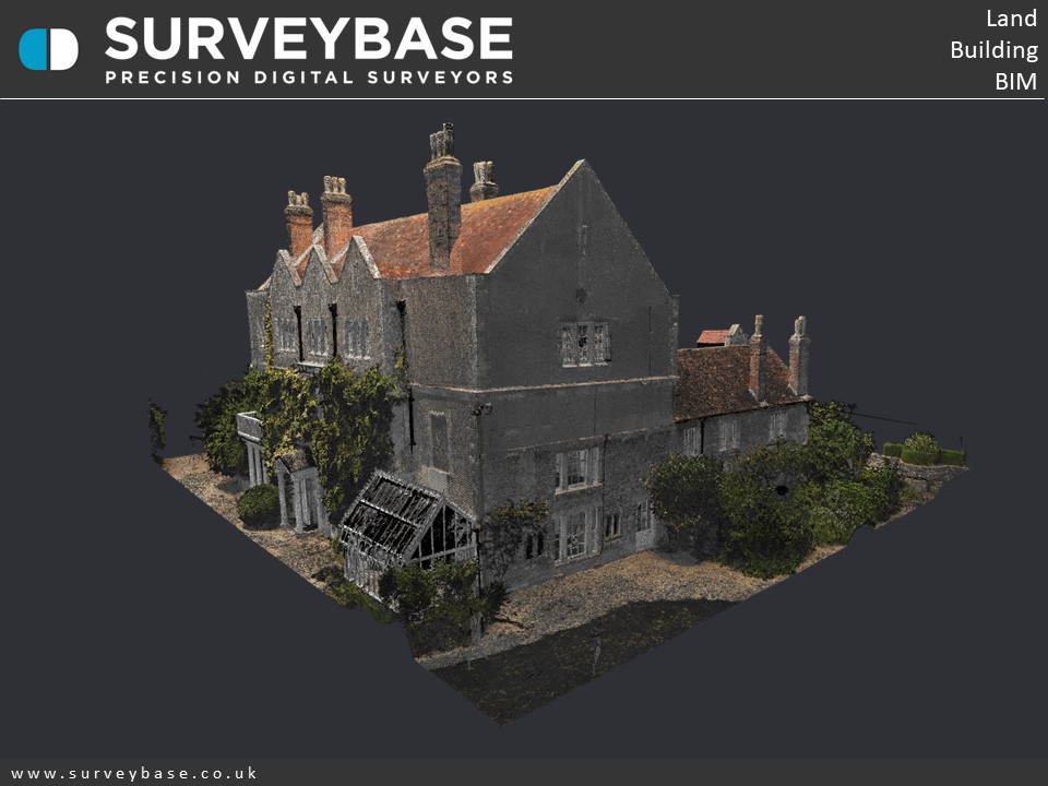
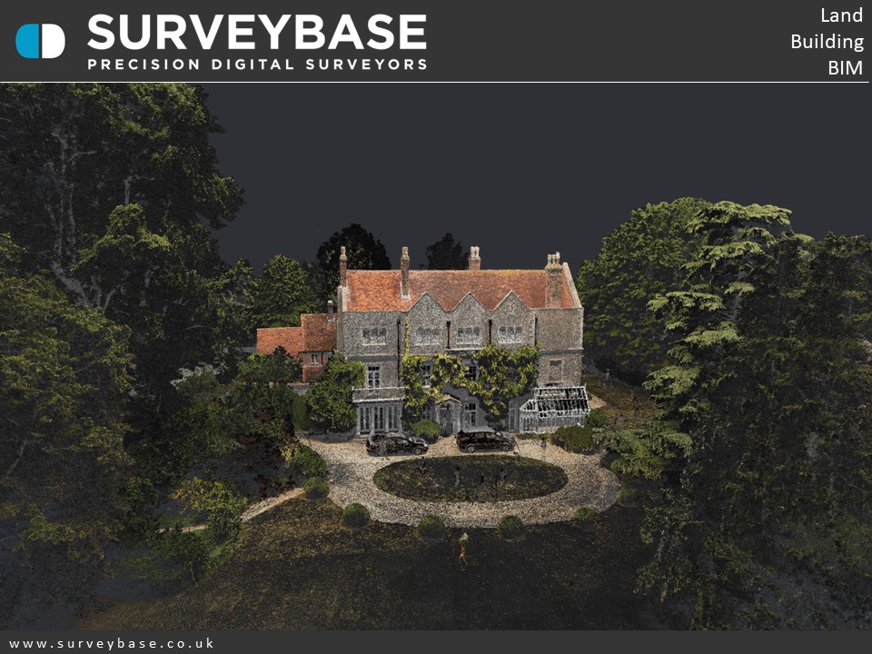
The Topographical & Measured Building Survey of a Manor House, Oxford.
This wonderful Georgian Manor House house is believed date back to the late 18th century, with subsequent 19th and 20th century additions and alterations and some parts dating from the 15th century.
The house sits in about 2 acres of gardens with lawns, mature trees and herbaceous borders, along with a paddock of about 3 acres.
The survey was undertaken with a Leica RTC360 Laser Scanner, Trimble Total Station, UAV Drone & GPS. The output included precision 2D heritage standard floor plans, elevations, sections, roof plan and internal elevations.
If you would like to find out more about our Topographical, Measured Building, or Scan To 3D Revit survey services please visit the Surveybase website or call your local office;
Bristol 01225 314370, Reading 0118 2072508, London 02039 066892 or Cambridge 01223 632613.
To obtain a quotation please email your brief to Quote@surveybase.co.uk or use our online quotation portal; Fast Quote.
Surveybase Limited are a precision digital surveying practice working on residential and commercial developments across the South of The U.K.
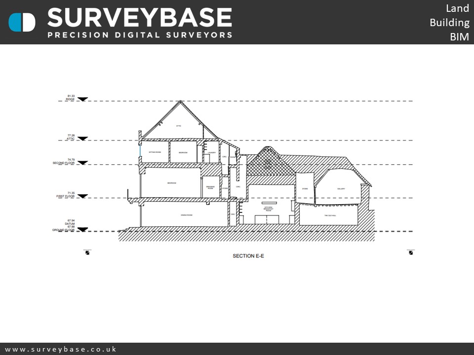
sections
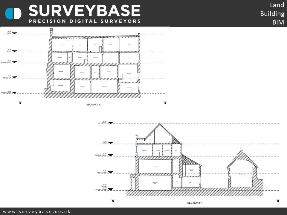
sections