LAND REGISTRY PLANS
SURVEYBASE HAVE PREPARED LAND REGISTRY PLANS SINCE FOUNDATION IN 1998. WE WORK WITH SOLICITORS, TITLE HOLDERS, AND DEVELOPERS TO ESTABLISH LAND REGISTRY COMPLIANT PLANS FOR INITIAL REGISTRATION, CONVEYANCE AND LEASE.
Land Registry Plans are a legal requirement of Title Registration, Title Division, Title Transaction and Property Lease. Our vast experience of precision Land and Measured Building Surveying provides assurance in a professional and efficient service solution.
WHAT ARE LAND REGISTRY TITLE PLANS
Land Registry Plans are scaled drawings that delineate title boundary, site and surrounding buildings, adjoining roads, junctions, and landmarks along with any easements or restrictions. The HM Land Registry guide states that plans submitted for title applications are.
- Drawn to a suitable scale (1:1250, 1:500 or 1:200).
- Display the correct orientation & north point.
- Referenced to an Ordnance Survey plan.
- Red lined to confirm Title Boundary.
![]()
TOPOGRAPHICAL
- BOUNDARY PLANS
- DETAILED SITE PLANS
- SITE SECTIONS
- SITE CONTOURS
- XYZ POINTS (.CSV)
- LAND REGISTRY PLANS
WHAT ARE LAND REGISTRY LEASE PLANS
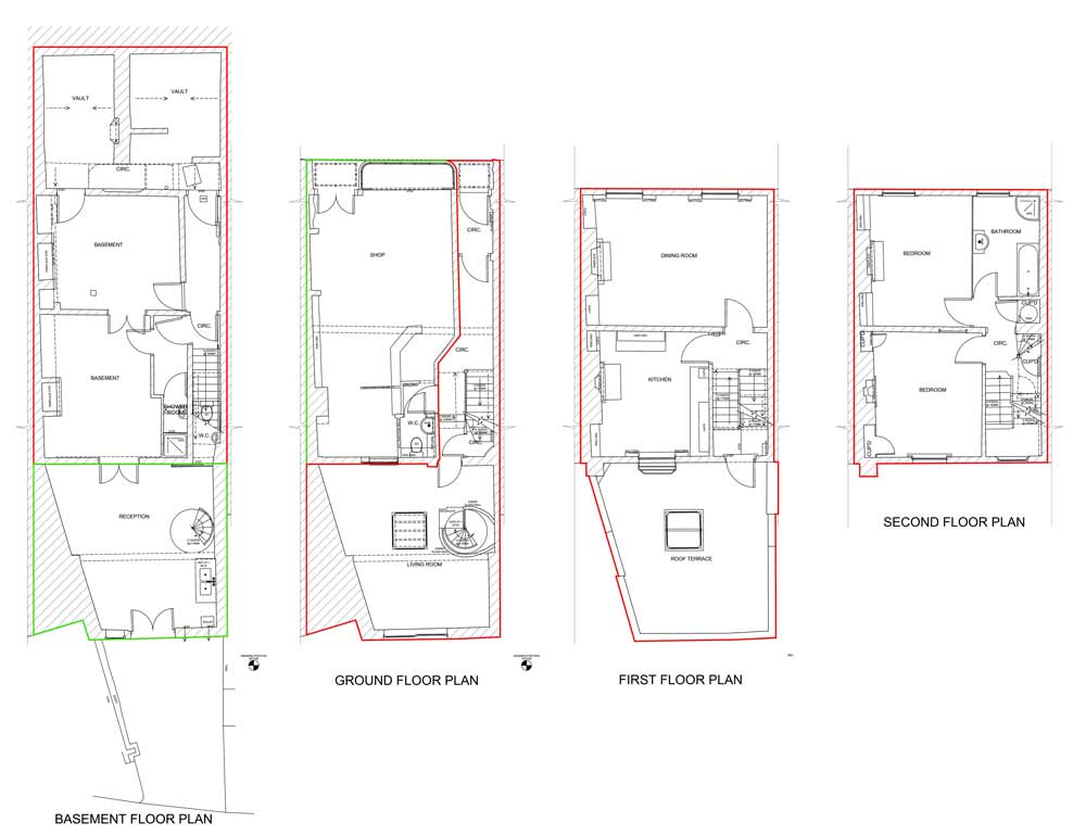
A Lease Plan includes the property’s title boundary, site and surrounding buildings, adjoining roads, junctions, and landmarks along with identification of land and building areas included in the lease agreement. A Lease Plan is typically used in the lease of commercial and residential property to define the extent of the tenant’s rights and obligations. It typically includes measurements, such as the property’s total area and the area being leased.
DO I NEED A LAND REGISTRY PLAN
You will need A Land Registry Plan if;
- Selling Unregistered Land
- Changing The Boundaries of A Registered Title
- Dividing Land into Two Or More Parts
- Leasing A Property
Failing to provide a compliant Land Registry Plan can cause your applications to be delayed or rejected, a time-consuming and costly process.

BENEFITS OF A LAND REGISTRY PLAN
Land Registry Plans provide certainty of ownership and protection from third party claims and boundary disputes. They clarify title registration and division and expedite property transfer, conveyance, and lease. We recommend that Clients protect their property assets with accurate Land Registry Plans to;
- Provide Certainty Of Ownership.
- Provide Protection From Third Party Claims.
- Provide Protection From Boundary Disputes
- Expedite Property Registration, Division, Conveyance & Lease

SERVICE OPTIONS
DIGITAL RECORDS
We frequently create Land Registry Plans using existing digital plans or scaled boundary drawings without the need for site survey. We reference the existing digital records to an Ordnance Survey tile and produce a compliant Land Registry Plan.
BOUNDARY SURVEY
If we cannot use existing digital records, we will undertake a Boundary Survey. Our expert Land Surveyors use the latest GPS and Total Station instruments to plot existing building footprint and perimeter boundaries. We reference the site data to an Ordnance Survey tile and produce a compliant Land Registry Plan.
MEASURED BUILDING SURVEY
If we cannot use existing digital records, we will undertake a Measured Building Survey. Our expert Measured Building Surveyors use the latest GPS and Laser Scanning instruments to record the architectural layout of existing buildings. We reference the site data to an Ordnance Survey tile and produce compliant Land Registry Plans that confirms the lease demise and lease area.
How Can We Help
Surveybase has over 25 years’ experience in delivering precision digital survey solutions to the AEC industry. Let's discuss your requirements and to see how our expertise will benefit your next project.

Talk To Our Expert
Request a Quote
To obtain a quotation please email your survey brief to quote@surveybase.co.uk or use our online quote portal.

