Since 1997, Surveybase has been a trusted leader in 3D Laser Scanning. Providing nationwide coverage, we deliver precise and dependable geospatial data for Point Cloud, 2D and 3D outputs, ensuring complete confidence in your project from day one.
What projects can benefit from 3D Laser Scanning?
3D Laser Scanning is a versatile tool that can enhance a wide variety of projects across multiple industries. Its precision and ability to capture complex details make it ideal for a range of applications, including:
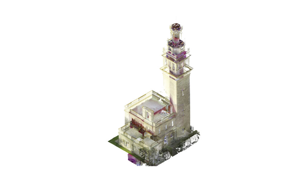
Heritage and Conservation Projects – Capturing detailed measurements of historic buildings, monuments, and landscapes to inform restoration, conservation, and preservation efforts.
Architectural Design and Renovation – Providing accurate, real-world data for architects to create as-built drawings or design new builds that integrate seamlessly with existing structures.
Construction and Engineering – Supporting site analysis, 3D modelling, and progress monitoring, ensuring projects are completed on time and within budget by providing accurate as-built conditions.
Infrastructure and Civil Engineering – Surveying roads, bridges, tunnels, and utilities for planning, monitoring, and designing efficient infrastructure systems.
Building Information Modelling (BIM) – Generating 3D data that can be integrated into BIM workflows, improving collaboration and decision-making throughout a building’s lifecycle.
Industrial Projects – Capturing large, complex environments such as factories or power plants for maintenance, retrofitting, and safety assessments.
Landscaping and Environmental Surveys – Mapping terrain, vegetation, and landforms for environmental studies, site planning, and landscaping projects.
Surveying of Hard-to-Access Areas – Ideal for capturing data from difficult-to- reach or hazardous areas, such as high-rise buildings, bridges, or industrial sites.
Whether it’s for new developments, conservation projects, or ongoing maintenance, 3D Laser Scanning provides the accuracy and detail needed to support every phase of a project, from design to completion.
What is 3D Laser Scanning?
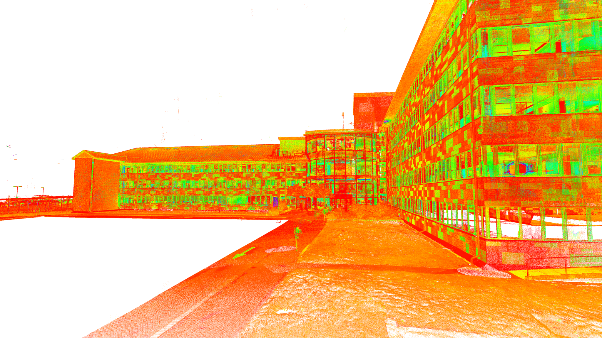
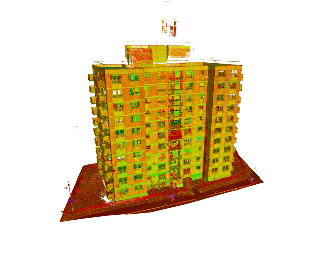
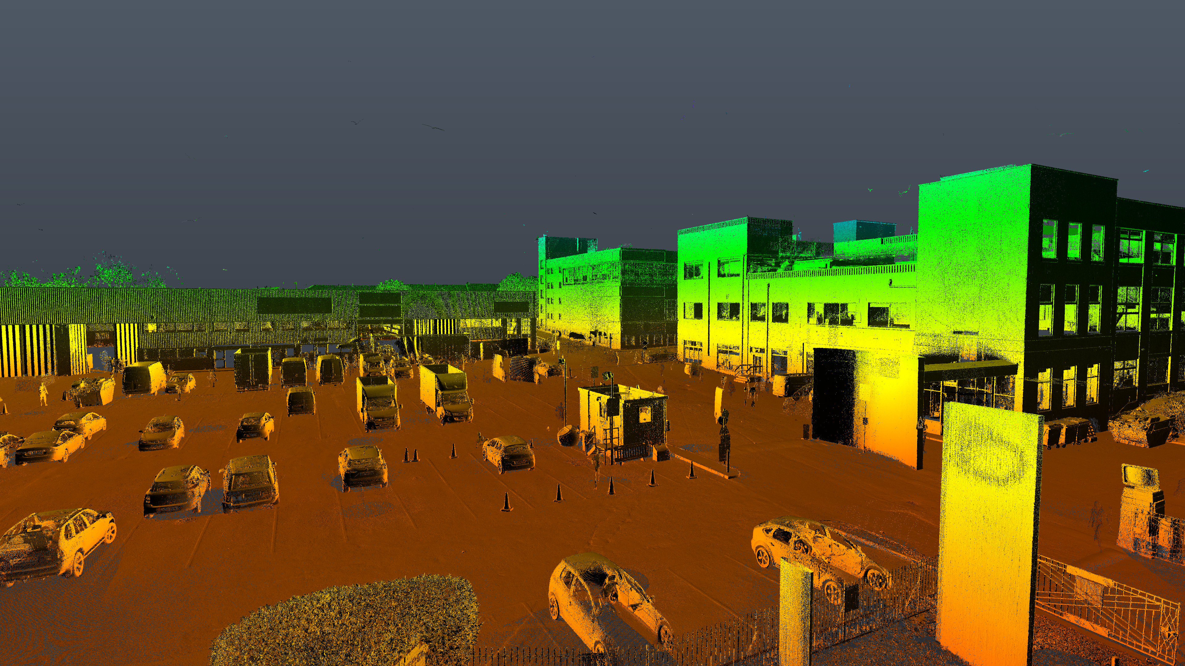
3D Laser Scanning is a cutting-edge surveying technique that captures the precise shape, size, and spatial relationships of buildings, structures, and landscapes. Using advanced laser scanning equipment and UAV drone technology, millions of measurements, known as Point Clouds, are recorded with exceptional detail and accuracy, creating a digital 3D representation of the physical environment.
This non-invasive method is ideal for complex, detailed, or hard-to-access areas, and is widely used across architecture, construction, heritage, and engineering sectors. The data can be processed into geospatial information, 2D drawings, or 3D BIM models, supporting design, planning, and analysis with a level of precision that far exceeds traditional surveying methods.
Surveybase leads the industry in 3D Laser Scanning, providing fast, reliable, and cost-effective data that empowers informed decision-making and drives project success at every stage.
Two-Tier Survey
We offer a flexible, two-tier approach to 3D Laser Scanning, tailored to meet your specific objectives and budget. This solution is built on our extensive experience delivering a cost-effective approach.
LEVEL ONE - MONOCHROME
Level one provides a monochrome Point Cloud, offering a cost-effective and efficient solution for capturing the geometry of a site or building. This option delivers high-accuracy 3D data to inform planning and design, making it an ideal choice for projects where detailed colour or texture mapping is not required.
LEVEL TWO - FULL COLOUR
Level two delivers a full colour Point Cloud, providing a highly detailed and accurate 3D representation of your site or building, complete with realistic colour mapping. This option is ideal for projects where visual detail and texture are critical, offering enhanced clarity for design, analysis, and presentation purposes.
3D Laser Scanning
Deliverables
Full Colour Point Cloud
Monochrome Point Cloud
TruViewer
3D Revit (BIM) Models
2D (DWG/ DXF) Roof & Elevation Plans
3D Mesh Models
Panoramic Imagery
IPMS Area Measurement Reports
Frequently asked questions
How does 3D Laser Scanning work?
We use laser scanners to capture millions of data points in the form of a point cloud. These points represent the precise measurements of the object or space being scanned. The data is then processed to create 3D models, CAD drawings, or other visual representations.
Can 3D Laser Scanning be used for both large and small projects?
Yes, 3D Laser Scanning is flexible and can be used for both large-scale projects, such as entire buildings or construction sites, as well as smaller, more detailed scans like individual rooms or architectural features.
How much does a 3D Laser Scan cost?
The cost depends on the size of the project, the complexity of the site, and the deliverables required. We can provide a custom quote based on your specific needs.
Unlock the benefits of integrated surveying services with Surveybase. Our comprehensive solutions combine a range of services to deliver efficient, accurate, and cost-effective results, supporting every phase of your project with precision and reliability.
Drone Surveys & Inspection
Surveybase provides high-precision Drone Surveying & Inspection services across the UK, delivering fast, cost-effective, and detailed aerial data. Our CAA-certified pilots use advanced UAVs with high-resolution cameras and LiDAR for precise, reliable surveys.
Since 1997, Surveybase has been a trusted leader in Topographical Surveys, offering nationwide coverage and delivering accurate, high-quality 2D and 3D survey data. Our proven expertise guarantees precise terrain mapping for design, planning, and compliance, ensuring total confidence in your project from the outset.
Since 1997, Surveybase has been a trusted leader in Measured Building Surveys. Providing nationwide coverage, we deliver precise and dependable 2D and 3D outputs, ensuring complete confidence in your project from day one.
Each project highlights our dedication to accuracy, innovation, and delivering integrated surveying services. Discover how we’ve helped clients achieve successful outcomes with precise, high-quality data.
We’re here to support your project with accurate surveys and expert advice. Get in touch today to speak to one of our experts and find out how we can help.
Request a quote
To obtain a quotation, please email your survey brief to: quote@surveybase.co.ukor use our online quote portal.